...
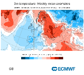
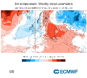
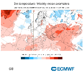
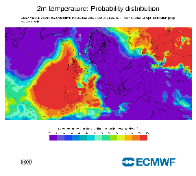
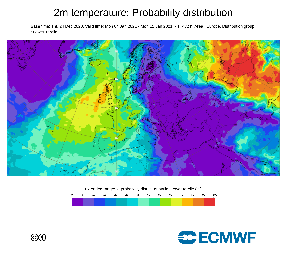
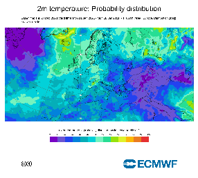
2-metre temperature
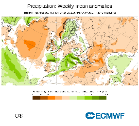
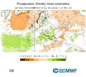
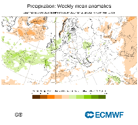
Total precipitation
Probability products
...
Forecast User Guide: Graphical Output
Extended-range EFI and SOT for 2-metre temperature
...
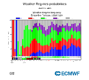
Extended Range Weather Regime Frequency histogram

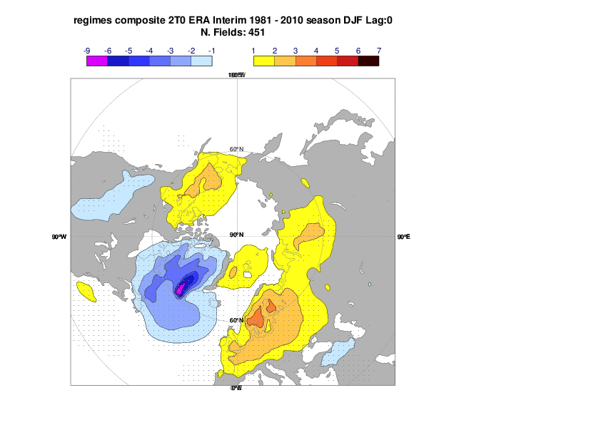
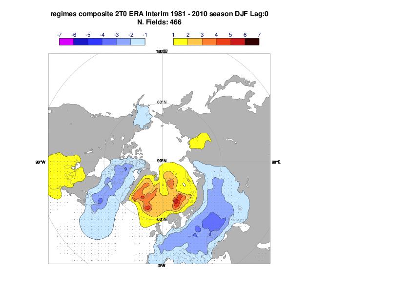
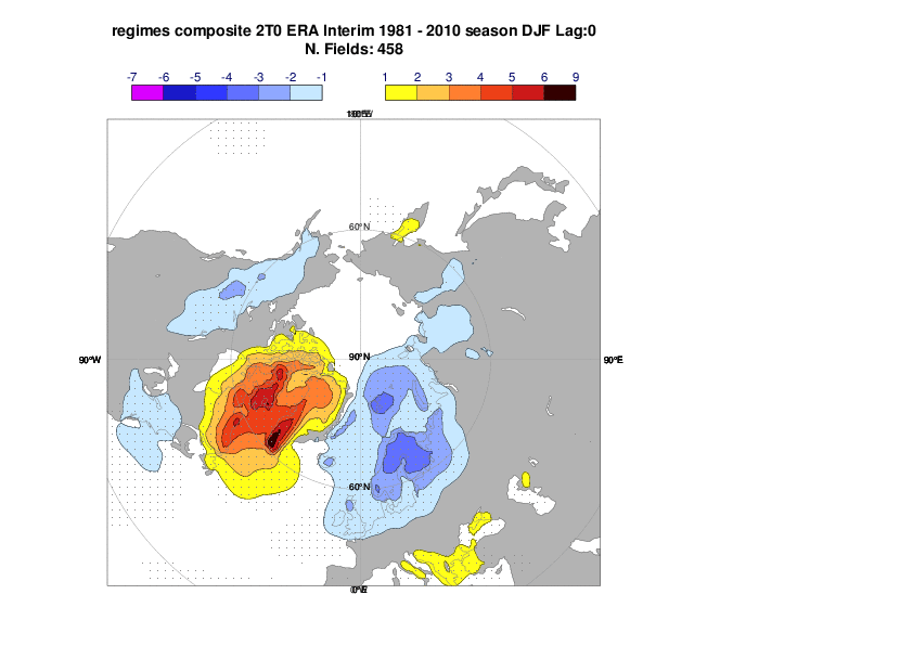
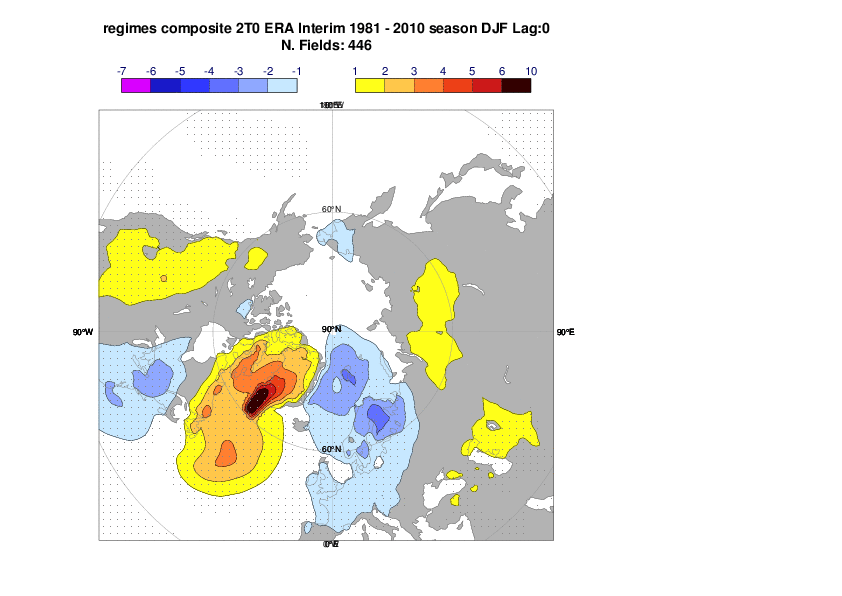
Composites of 2-metre temperature for the 4 Euro-Atlantic regimes
NAO+, Scandinavian Blocking, NAO-, Atlantic Ridge
...
Drivers of predictability
...
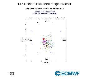
Wheeler-Hendon MJO diagram
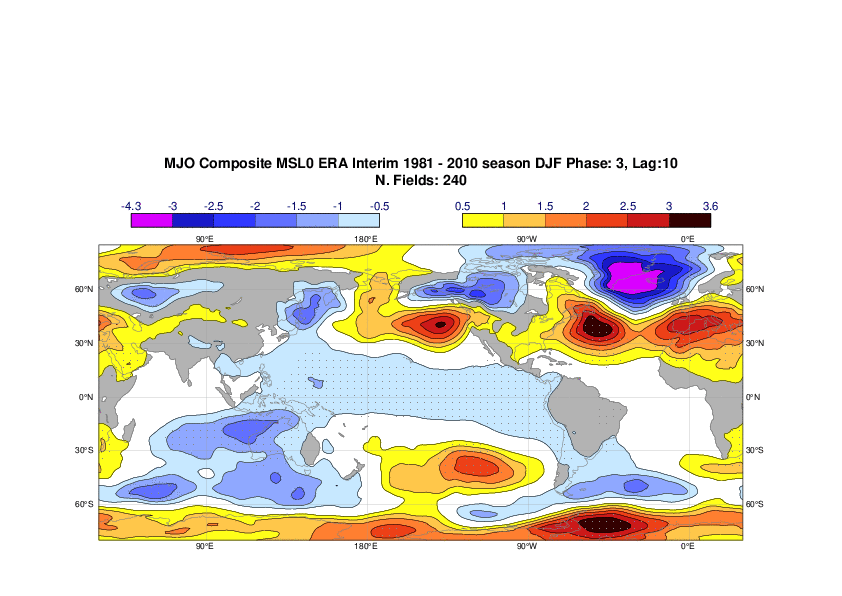
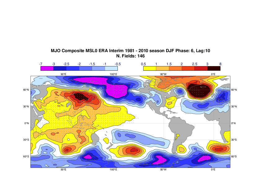
Teleconnection patterns from MJO in ERA-Interim (lag 10 days)
After phase 3 (left) and phase 6 (right)
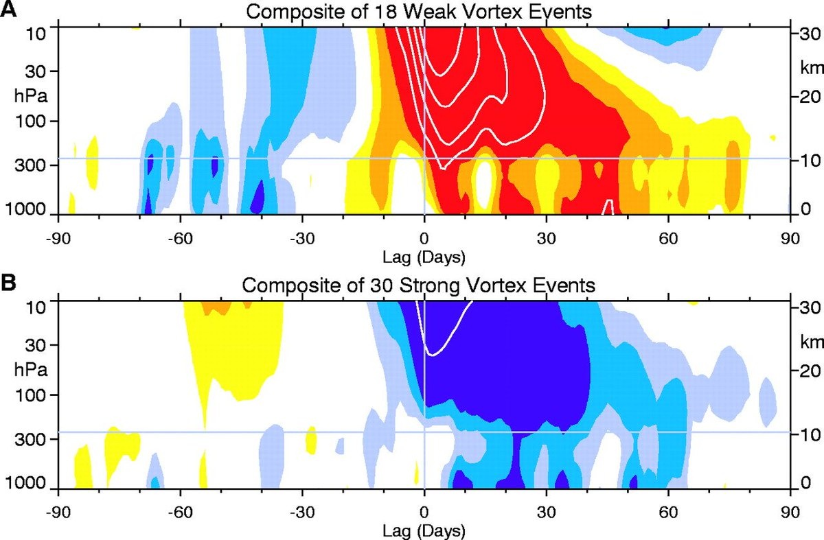
Sudden Stratospheric Warmings (SSW)
...
Composites of weak and strong Polar Vortex (from Baldwin and Dunkerton, 2001):
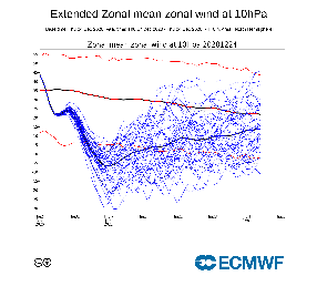
Plume of 10hPa zonal wind at 60N
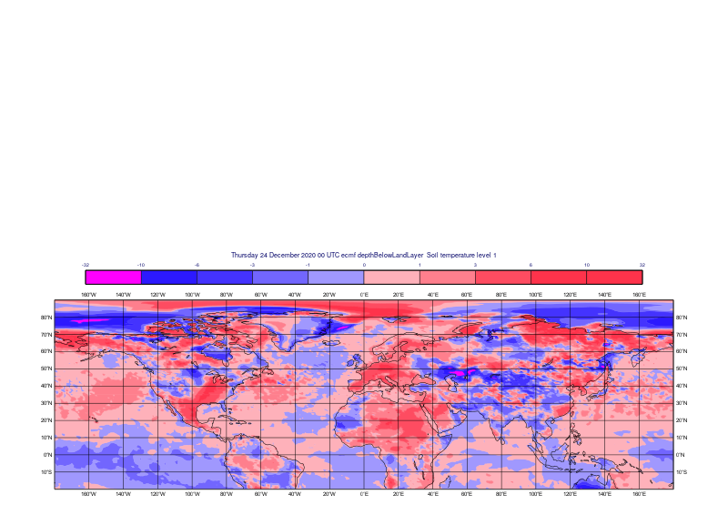
Add initial Initial anomalies for SST and snow depth/soil temperature