Status:Ongoing analysis Material from: Tim
Picture
1. Impact
2. Description of the event
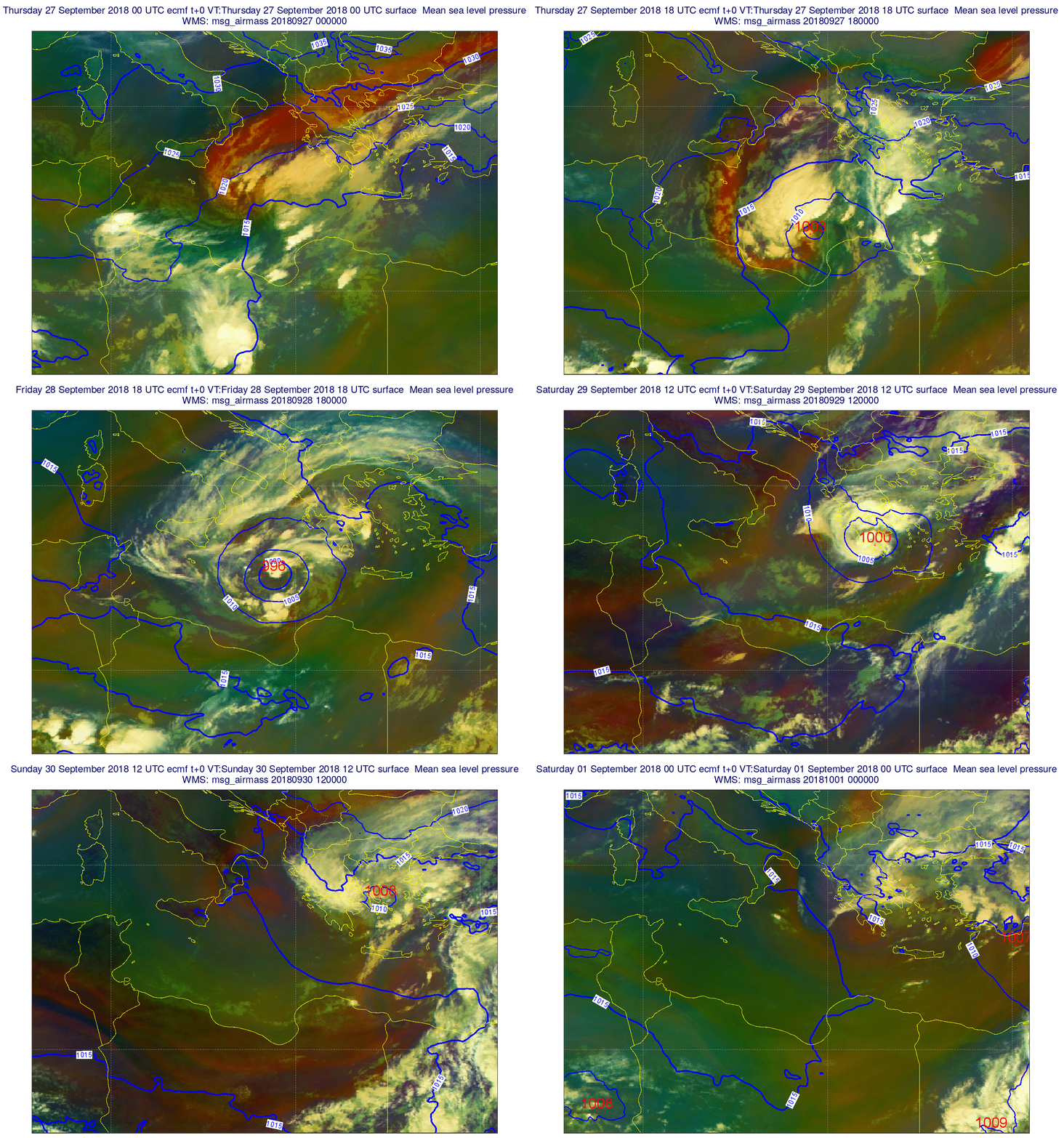
Air mass RGB animation from 27 September to 30 September 2018 inclusive.
ECMWF analysis of MSLP and air mass RGB, animation every 6 hours covering the period from 27 September 00UTC to 1 October 2018 00 UTC.
3. Predictability
3.1 Data assimilation
3.2 HRES
3.3 ENS
3.4 Monthly forecasts
3.5 Comparison with other centres
4. Experience from general performance/other cases
5. Good and bad aspects of the forecasts for the event
- Unusually large differences between DA and LWDA analyses in the vicinity of the incipient cyclone near Libya => late data impact
- IFS probably the first, of the international models, to forecast the genesis of this cyclone
- Some early HRES forecasts were too intense, giving medicanes much deeper than had ever occurred before in the Mediterranean (though not necessarily impossible, theory suggest that a level equivalent to CAT 1 hurricane is possible for a medicane)
- ENS and HRES exhibited similar track errors in the medium range - mostly the tracks were a bit too far south - e.g. near to or just N of Crete
- Ppn forecasts in the medium range were "contaminated" by track errors
- IFS analyses of the system near to Greece were poor, central mslp values ~10-15mb too high. Likewise the core of strong gradients and strong surface winds was notably missing in these analyses
- Better analyses could in principal have been realised by better use of high density scatterometer data. It is probably the data thinning that stops us realising this benefit (though that may have other associated problems).

