Page History
...
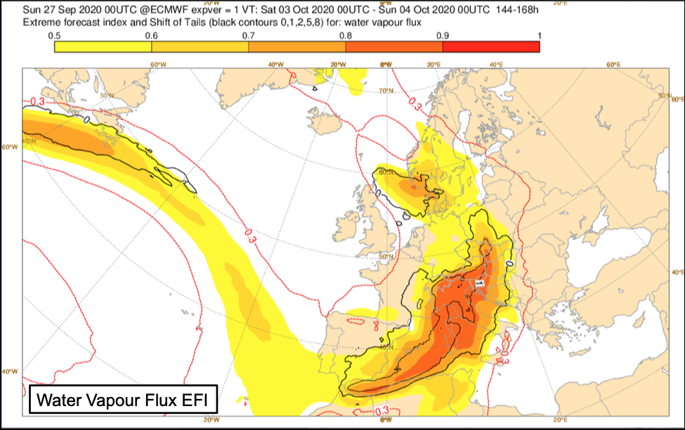
- Water vapour flux EFI tends to show up a signal earlier in the forecast than the total precipitation EFI.
- Extreme water vapour flux EFI can enable earlier awareness of extreme precipitation, and in particular early identification of the risk of flooding.
- Consideration of other factors such as orography can help interpretation of the forecasts (e.g. west coasts of continents or enhancement of orographic precipitation on windward slopes in regions of high water vapour flux EFI).
- It can be especially helpful where complex topographic details are not well captured at ensemble resolution and forecast sub-synoptic flow can result in underestimation of precipitation values and EFI on the upslope side (and overestimation on the downslope side). The broader scale flow implicit in evaluation of water vapour flux EFI gives better indication of risk areas.
- Heaviest precipitation often occurs at the edge of the area with large water vapour flux EFI.
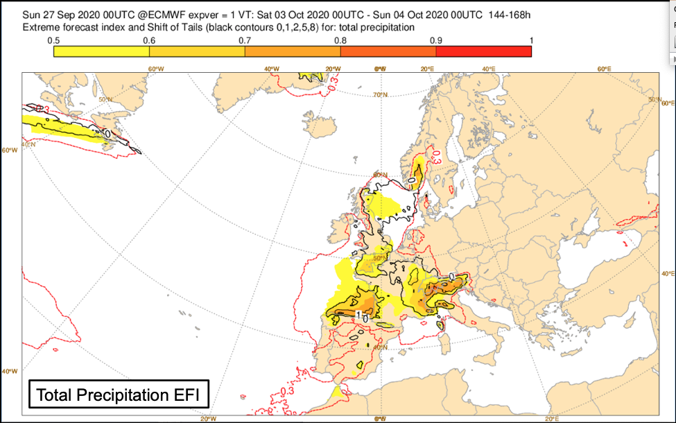
Fig8.1.12-1:Extreme Forecast Index and Shift of Tails for Total Precipitation and Water Vapour Flux. EFI (shading) and SOT (black contours) in the forecast DT 00 UTC Monday 27 September 2020 for 24-hour period VT 00UTC 3 October to 00UTC 4 October 2020. Correspondence is evident between areas larger of Water Vapour Flux EFI and Total Precipitation EFI, particularly over Europe.
...
Overview
Content Tools

